Murewa (Murehwa)
Murewa (also spelled Mrewa or Muhrewa) is a township (and district) in Zimbabwe, 75 kilometers northeast from the capital of Harare, at the road to Tete (Mozambique). It is situated almost 1400 m above sea level. In 2002, the number of inhabitants was 8398. Public and private buildings are simple. "Growthpoint" and village have the character of a township. Nearby there are the Murewa Caves having three tunnels, some as short as 9 km, and other sites with rock paintings of the San. These paintings are at least 1000 years old.
The district of Murewa stretches from Mt. Hanwa (10 km north of Macheke) in the south up to Uzumba in the north, Nyadire Rive NE and Nyaguvi SE of Murewa. It is dominated by traditional African agriculture of the Shona people. Only the southern quarter of the area is covered with commercial farms, founded by European settlers. In that area there are three hilltop fortresses belonging to the Murewa (Moyo) people, built in the later phase of ancient Monomotapa State under the Chieftainship family on Murewa, after 1500 AD.
The district of Murewa stretches from Mt. Hanwa (10 km north of Macheke) in the south up to Uzumba in the north, Nyadire Rive NE and Nyaguvi SE of Murewa. It is dominated by traditional African agriculture of the Shona people. Only the southern quarter of the area is covered with commercial farms, founded by European settlers. In that area there are three hilltop fortresses belonging to the Murewa (Moyo) people, built in the later phase of ancient Monomotapa State under the Chieftainship family on Murewa, after 1500 AD.
Map - Murewa (Murehwa)
Map


Country - Zimbabwe
 |
 |
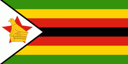
| Flag of Zimbabwe | |
The British South Africa Company of Cecil Rhodes demarcated the Rhodesia region in 1890 when they conquered Mashonaland and later in 1893 Matabeleland after a fierce resistance by Matabele people known as the First Matabele War. Company rule ended in 1923 with the establishment of Southern Rhodesia as a self-governing British colony. In 1965, the white minority government unilaterally declared independence as Rhodesia. The state endured international isolation and a 15-year guerrilla war with black nationalist forces; this culminated in a peace agreement that established universal enfranchisement and de jure sovereignty as Zimbabwe in April 1980. Zimbabwe then joined the Commonwealth of Nations, from which it was suspended in 2002 for breaches of international law by its government under Robert Mugabe and from which it withdrew in December 2003.
Currency / Language
| ISO | Currency | Symbol | Significant figures |
|---|---|---|---|
| ZWL | Zimbabwean dollar | 2 |
| ISO | Language |
|---|---|
| SN | Shona language |